Stop 1 • Sunrise at Mono Lake, Lee Vining, CA
Left our hotel in Mammoth Lakes early enough to get here just before sunrise.
I had calculated that this might be the perfect spot to see the sunrise with reflections on the lake.

↓ All the pics ↓
Stop 2 • Tufa on the south side of Mono Lake
After sunrise, we stopped and filled up the gas tank, then filled up our stomachs.
After breakfast, we moved to the south side of the lake to see the "tufa".
What are tufa you ask?
Tufa is a soft, porous sedimentary rock made of calcium carbonate that precipitates out of water from lime-rich springs, rivers, or lakes. (Copied that from the internet)
In the case of Mono Lake, which is a salt lake, it is fresh water springs in the lake bed, seeping up
minerals into the lake that combine with other minerals to make these soft rock structures.

↓ All the pics ↓
Stop 3 • Rock formations at the intersection of CA-120 and Benton Crossing Rd
So let me tell you how we got here. The normal thought would be to go directly from the "tufa"
location, since it is just off of CA-120, and drive directly east the 35 miles or so to the formations.
BUT NO! Steve wants to take the "scenic route".
From the tufa west on CA-120 to US-395. North to CA-167 (on the north side of Mono Lake) to NV-359, which is what CA-167 becomes when you cross the state line into Nevada, to Hawthorne, NV.
Change roads in Hawthorne to US-95 south to NV-360, southwest to US-6, crossing back into California, heading west on CA-120 at Benton, and then arriving at the rock formations. 159 miles.

↓ All the pics ↓
Stop 4 • Entering Yosemite National Park
So after starting in Lee Vining (at least photographically), we'll also end this day by entering,
and exiting, Yosemite NP from Lee Vining. 12 miles from US-395 to the park entrance.


→ I'd like to also mention, that this sign was at the entrance booth, and is also posted in several places throughout the park.
→ I'd just like to say, that if they are so concerned about these bears, why don't they do a better job teaching them to observe the speed laws when they are driving, so that they would be less likely to do harm to themselves or to others?
→ If they continue to refuse to obey the speed laws, then I think we are going to have to suspend their driver's licenses.
☺
↓ All the pics ↓
Stop 5 • Tuolumne River
The river was much more subdued than I am used to seeing it, but I also don't think I've seen it this late in the year. I found several pools with no inlet or outlet with trout in them that will probably not make it.

↓ All the pics ↓
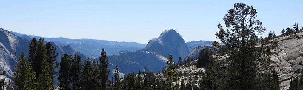
Stop 6 • Viewing Half Dome from Olmsted Point
We drove 17 miles into the park to reach this vista point. You can clearly see Half Dome from here.
↓ All the pics ↓
Stop 7 • Tenaya Lake
We actually passed this lake on our way to Olmsted Point, but decided to stop here on our way back out of the park. It's a very big lake, about a mile long, with lots of campgrounds along the road.

↓ All the pics ↓