Gloss Mountains State Park
This was the first day of our vacation in 2011. Our first stop was the Gloss Mountains in western Oklahoma. We’ve stopped here before, but we are still amazed by this little oasis of beauty in the middle of nowhere. These mesas rise 500 feet above the plains and have a cap that is something like quartz. When you walk on the top you can hear it echoing under your feet. Very strange.

Boise City
Our hotel in Boise City, OK

July 2, 2011
On our second day we traveled from Boise City, OK to Farmington, NM.
On the way we stopped on US 64 for lunch just north of the Philmont Boy Scout Ranch. Because of fires in MN and AZ most of the state parks in NM were closed. We stopped at the Rio Grande Gorge Bridge just west of Taos, NM. It was very impressive.
410 miles • 7 hours; 36 minutes driving time.
Cimmaron Canyon State Park
Along US-64 between Cimmaron and Eagle Nest, we stopped here for lunch.

Rio Grande Gorge Bridge
First time I've ever been on a bridge that had suicide prevention notices on it. It is VERY high and windy too!

July 3, 2011
On our third day we traveled from Farmington, NM to Blythe, CA.
We went south from Shiprock, NM to Window Rock, NM, then on I-40 to Ash Fork, AZ. We stopped for lunch somewhere off the highway west of Flagstaff, but if you asked me to find it again I’m not sure that I could. From Ash Fork, we headed south through Prescott, and connected with I-10 just east of Blythe, CA, where we spent the night.
559 miles • 9 hours; 18 minutes driving time.
Shiprock, NM
Only one of these pics is actually the monolith, the others are along the highway south of town.

Window Rock, AZ
Window Rock, the geology giving name to the capital of the Navajo Nation. This location is also home to a memorial for the Code Talkers who served our Country during WWII.

Near Williams, AZ
I'd never be able to find this place again.
We just pulled off I-40 somewhere just east of Williams, AZ,
found a quiet place, and made our lunch along a dirt road.

July 4, 2011
On the fourth day we left Blythe, CA and ended our trip at my parents house in the San Fernando Valley.
We stopped at the Salton Sea and a place called the Devil’s Punchbowl. We went from I-10 (in a roundabout way) to I-15 and got off at highway 138. From there we drove through Wrightwood, and took the Big Pines highway along the mountains all the way to where highway 14 leaves Palmdale heading to LA. Devil’s Punchbowl is along the Big Pines highway.
313 miles • 5 hours; 31 minutes driving time.
Salton Sea, CA
Smelly, but beautiful. This salt lake was created accidentally when a
canal being fed by the Colorado River broke in 1905, and it took almost 2 years to fix.

Mormon Rocks, CA
A large rock formation at the the north end of Cajon Pass.

Devil's Punchbowl, CA
These rock formations near Pearblossom, CA include a trail deep in the canyon. Quite fun, ever on a very hot day.

July 5, 2011
Fifth day was a rest day in the San Fernando Valley, where we would be based for the next 5 days.
We just hung out and did nothing. Except enjoy each others company.
3 miles • 9 minutes driving time.
Dinner at Carol's House
Here we are getting ready to have dinner at Carol’s house. Patti is sporting her short “do”. That’s as much as had grown back after her chemo treatments.

July 6, 2011
Day 6 → Beach day!
91 miles • 2 hours; 16 minutes driving time.
Leo Carrillo State Park, CA
On the sixth day we took a trip to the beach.
We went to Leo Carrillo State Park. I took a side trip across the highway and went hiking to the top of a hill overlooking the beach.
It took longer than I thought it would. No one had called the search and rescue teams yet, but they weren’t too worried because Dan had the car keys, not me.

July 7, 2011
On the seventh day some of us saw some local sites in Los Angeles, CA.
On day seven we went to Traveltown, which is an outdoor museum of trains, and to Griffith Park Observatory. We had a great time with my sister Patti. Patti’s cancer was progressing and it wouldn’t be much longer before we couldn’t do these types of things any longer. It was a blessed day.
37 miles • 1 hour; 4 minutes driving time.
Traveltown, CA
A train musem, with lots of trains we could climb into.
Plus - A TRAIN RIDE!!!

Griffith Park Observatory, CA
Fascinating place, with lots and lots of info about our solar system. Worth the trip.

July 8, 2011
Day 8 saw me fixing the patio. A brick had fallen into a hole in the patio.
When I opened it up to see what had happened I found a huge void where there was once a tree stump.
When we first moved to that house in 1971 my dad and I had tried to dig up a big stump.
By the time we got to the tap root, the stump was so far down in the hole that we just left it there.
Should have taken it out! Later that day some of us went for a hike at O'Melveny park.
19 miles • 31 minutes driving time.
Fixing the patio
Added some backfill, then re-mortered the brick.

Feral Cats
My parents don't feed them, but I guess they like the quiet backyard to raise their kittens in.

Hiking at O'Melveny Park, CA
One of our favorite places to hike in the San Fernando Valley, on the north side of LA.

July 9, 2011
Day 9 was a "do nothing" day
Didn't even drive around the block!
Chillin' at Mom & Dad's house
No plans for today other than to sit around and spend time with family.

July 10, 2011
We left the LA area and headed up to Mammoth Lakes, CA.
We checked into our hotel and then went hiking up to the Sherwin Lakes. I had never been there before and we were all very pleasantly surprised at how beautiful it is. We of course, stopped on the way in Independence, CA at my favorite park.
297 miles • 4 hours; 54 minutes driving time.
Dehy Park, Independence, CA
Stopped for a short break at one of our favorite parks.

Hiking up to Sherwin Lakes, CA
A significant hike up to Sherwin Lakes - in the Mammoth Lakes area.

July 11, 2011
Of course, no trip to the Mammoth Lakes area would be complete without at least a short stop at Convict Lake.
20 miles • 26 minutes
Hiking up Convict Creek behind Convict Lake, CA
On this particular trip our goal was to hike up to Mildred Lake, but alas, it was not to be. Everyone we talked to (including the rangers) said it would be way too dangerous to attempt the stream crossing.
So we hiked to where we would have crossed and took a break there. It was still a wonderful hike.

July 12, 2011
The next day we drove from Mammoth Lakes, CA to Cedar Breaks National Monument in Utah.
We stopped for lunch in the middle of nowhere, NV, and then, after checking into our hotel in Cedar City,
we drove to the national monuments and did some hiking. Breathtaking!!
468 miles • 7 hours; 56 minutes driving time.
Leaving Convict Lake, CA
Headed east on Benton Crossing Road, which would lead us toward Nevada. Had to dodge some cows on the way out.

Lunch in the middle of nowhere Nevada
Pretty much nothing but desert between Tonopah, NV and Cedar City, UT. Just had to stop somewhere to make some lunch.
The only shade was that provided by our tailgate.

Cedar Breaks National Monument, UT
Checked into the hotel in Cedar City, then headed up to the park. It's over 10,000ft and it's hard to breathe!

July 13, 2011
On the 13th we drove from Cedar City, UT to Salida, CO.
We drove through Cedar Breaks National Monument, then through Capitol Reef National Park, north to I-70, then east to Vail, CO where we turned south on hwy 24. We stopped in Leadville and ate at the worst Pizza Hut restaurant in the world, then continued south to Salida, CO. It was a long day.
602 miles • 10 hours; 31 minutes driving time (I did say it was a long day).
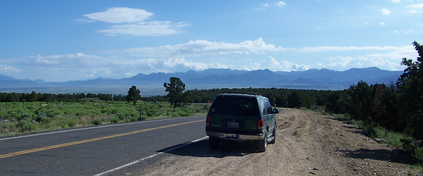
Cedar Breaks to Capitol Reef NP, UT
Driving from Cedar City, UT to Capitol Reef National Park. Mostly driving through the park on our way to Colorado.
Capitol Reef National Park, UT
You could shoot photos in the park all day, and still not capture the magnificence. It's an amazing place to stop and explore.

Hanksville, UT
Saw this little place that was covered in several types of structural art.
Hanksville is the town where we turned north to get to I-70.

Hanksville, UT to Salida, CO
Long drive from Hanksville, UT to Salida, CO. We crossed the Continental Divide near Leadville, where we ate dinner at the worst Pizza Hut in the nation.

Hotel in Salida, CO
After a long drive to get here, we stayed in a hotel.
Next day (14th) we headed south towards the Great Sand Dunes.

July 14, 2011
From Salida, CO to Guymon, OK
Starting out on the 14th we visited a place we had been once before called O’Haver Lake. At about 9,200 feet nestled in the hills. Then the Great Sand Dunes, and a spot not far from the dunes called Zapata Falls. The elevation there is 8,100 feet. We lunched there and then drove down to NM on I-25. Then east on US 64 to Guymon, OK to spend the night.
429 miles • 7 hours; 34 minutes driving time.
O'Haver Lake, CO
Stopped at a small lake at 9,200ft on the way to the Great Sand Dunes. About 2 miles off the highway

Great Sand Dunes NP, CO
This National Park has more sand than at the ocean, I think. We played for a while, then Geri went on a long hike.

Zapata Falls, CO
Just south of the Great Sand Dunes, we decided to lunch here. Then we hiked to the falls.

Zapata Falls, CO to Guymon, OK
Another long drive, this time from Salida, CO to Guymon, OK.

July 15, 2011
Last day of the trip, from Guymon, OK to home in Claremore, OK.
356 miles • 5 hours; 38 minutes driving time.
Driving by Gloss Mountains on our way home
Round trip passing through the Gloss Mountains again, just as we did on our first day. We didn’t stop there as we were tired and ready to be home.

Driving Summary
Trip totals... 15 days, 7 states, 4,021 miles, and 70 hours of driving.
Of course, the driving hours do not include photo stops, hiking stops, meal breaks, potty breaks, and any and all of any other reasons for stopping along the way.
DATE
DIRECTIONS
MILES
HOURS
July 2
Boise City, OK to Farmington, NM
410
7 hours; 36 minutes
July 3
Farmington, NM to Blythe, CA
559
9 hours; 18 minutes
July 4
Blythe, CA to Arleta, CA
313
5 hours; 31 minutes
July 5
Stayed in the San Fernando Valley
3
9 minutes
July 6
Went to Leo Carrillo State Beach
91
2 hours; 16 minutes
July 7
Sites in Los Angeles
37
1 hours; 04 minutes
July 8
Hiking at O'Melveny Park
19
31 minutes
July 9
Stayed at Mom & Dad's house
0
No driving today
July 10
Arleta, CA to Mammoth Lakes, CA
297
4 hours; 54 minutes
July 11
Hiking at Convict Lake
20
26 minutes
July 12
Mammoth Lakes, CA to Cedar City, UTG
468
7 hours; 56 minutes
July 13
Cedar City, UT to Salida, CO
602
10 hours; 31 minutes
July 14
Salida, CO to Guymon, OK
429
7 hours; 34 minutes
July 15
Guymon, OK to Claremore, OK
356
5 hours; 38 minutes
TOTALS
4,021
70 hours